


Brecklet Quarries
In addition to the well known East Quarry which is now a pleasant open space, and the West Quarries which are used as an Industrial Estate, Ballachulish has some lesser known quarries on the hillside above the village.
Modern maps don’t detail these old quarries particularly well, perhaps due to the dense forestry that has covered the slopes for the last half century. However, they are clearly marked on the old 6-inch Ordnance Survey map from around 1900 (click to enlarge):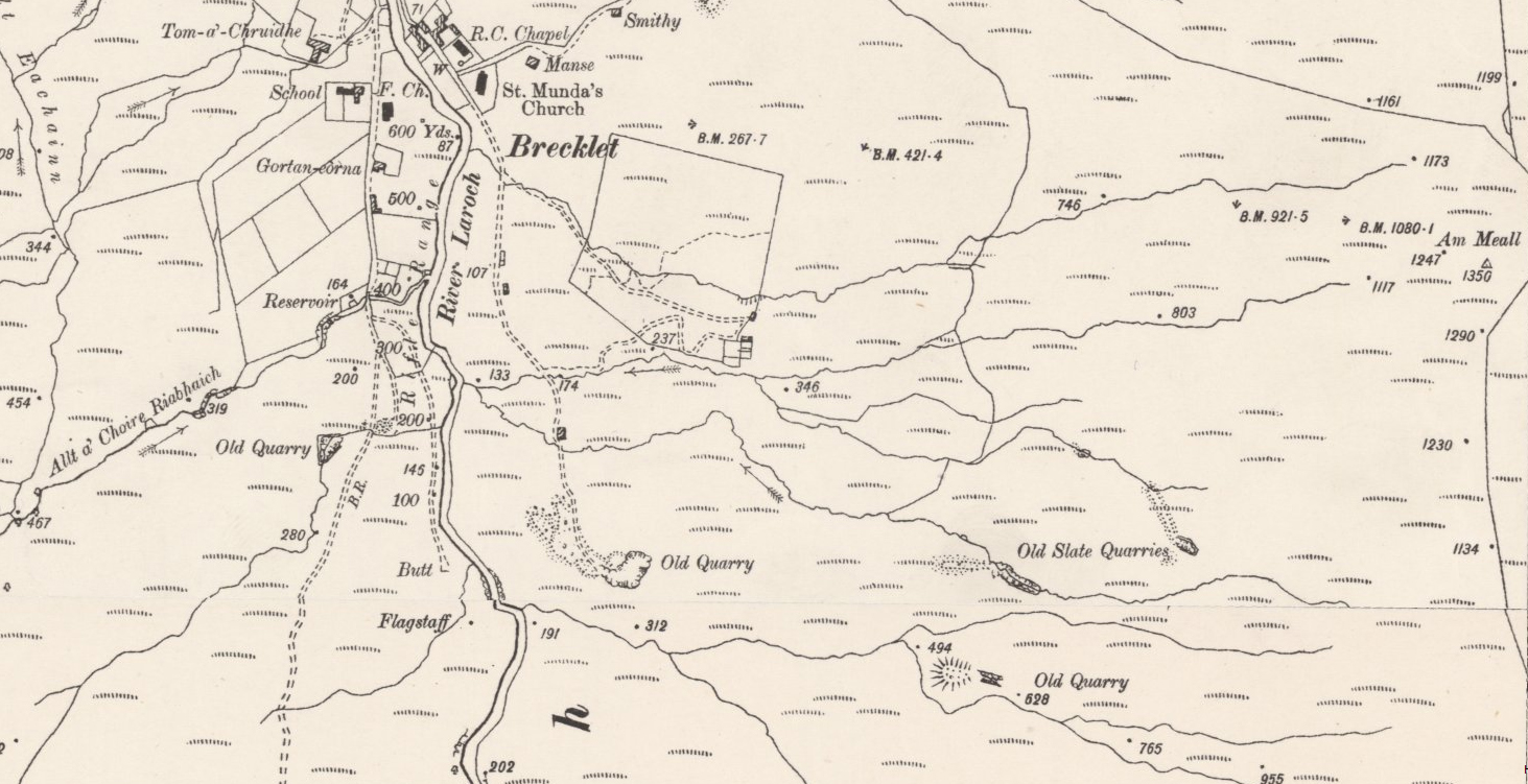
The quarry closest to the river is easy enough to get to, as it still has a track leading in to it, forking off the main Brecklet track near the old waterworks building – be careful as the area is used by the local archery club. This Quarry is known by many as Khartoum Quarry, although some people believe that this name actually applies to one of the higher quarries.
It is these higher quarries which we now turn to. For decades they have been buried in forestry, almost inaccessible, but now the hillside is being felled, the quarries are being revealed once more. IT IS NOT ADVISABLE TO TRY AND REACH THESE QUARRIES. It is still a difficult, potentially dangerous walk to locate them, and one perhaps best started from the visitor centre in Glen Coe. The forest road leads up and over Am Meall, before starting to drop down into Brecklet Forest. The quarries are almost invisible from above, and the ground is very difficult, steep, boggy and with rocks, tree stumps and brushwood strewn across the hillside. You should not leave the forest road unless you are confident in crossing such terrain.
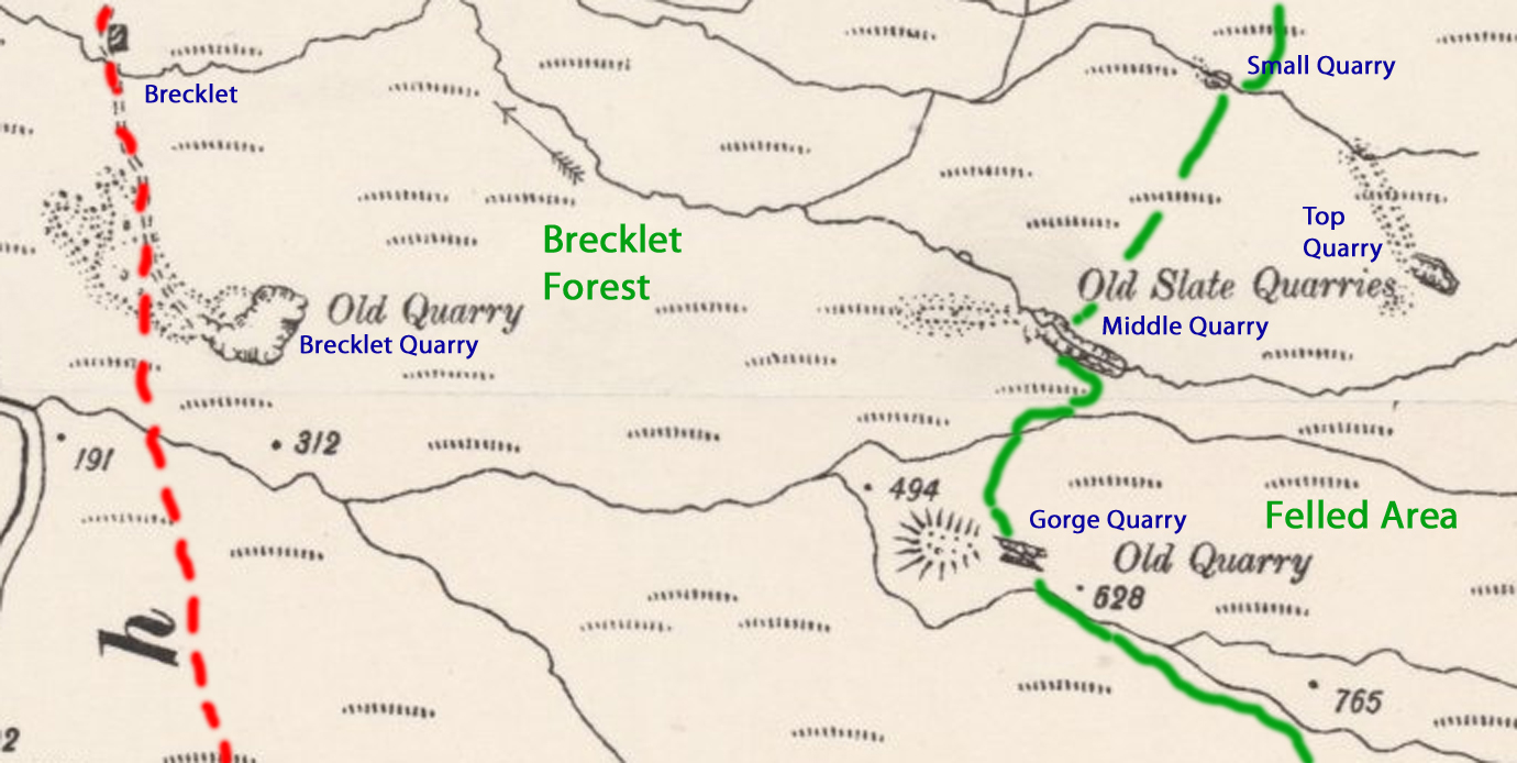 There are at least 3 quarries on the hillside. Modern maps are ambiguous, not clearly differentiating between the quarries and the spoil heaps or tips. However, an enlargement of the old map (again click to enlarge) shows 4 quarries marked above Brecklet. The photos and investigation were undertaken approaching dusk, so apologies if they are not as clear as they could be.
Small Quarry
This quarry has not been located. It appears to still be within the trees, and the small size may mean that it is no longer easy to identify.
Top Quarry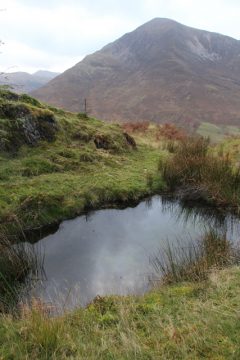
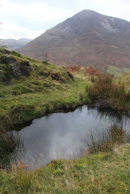
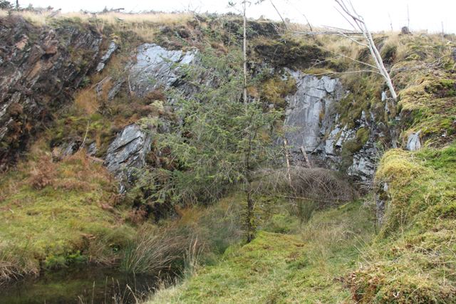
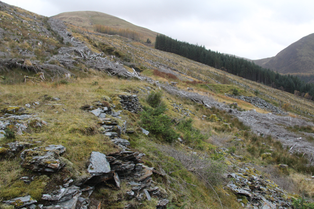
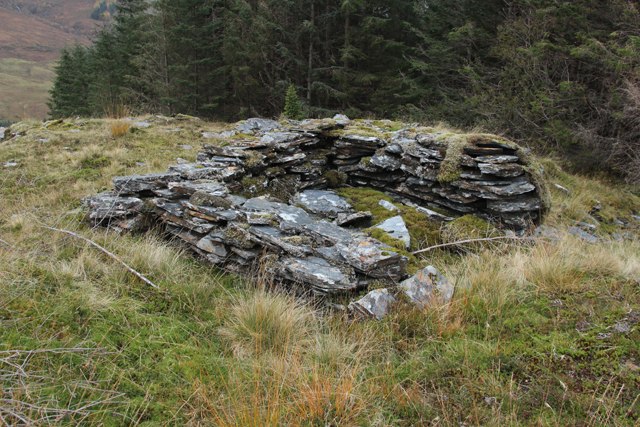
This quarry is the only one which is completely clear of the forest. It is also the largest and most recognisably a quarry of the four described here. The quarried cliffs stand some 20-30 feet tall and just like the bigger quarries, there is a small pool on the floor of the quarry. There are two large tips associated with this quarry, a circular heap stretching from the quarry mouth down the hill to the WSW, and a long bank along the hillside to the NE. This latter is clearly built up on the side of the hill, getting deeper the further north it runs, with a carefully leveled platform on the top. At the north end, the bank is perhaps 15 feet high above a stream although the precise shape of the hill underneath is clearly not known. At the northern end of the platform a rectangular set of 3 walls stands about a foot high suggesting some form of building once stood here.
Middle Quarry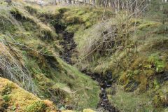

The middle quarry is not so clearly defined as the top quarry, largely thanks to the thick covering of grass, moss and ferns. However, it is possible to identify some bare patches of quarried rock face and pick out the outline of the quarry. There is a long tip associated with this quarry stretching out as a high grassy bank to the west, in a small clearing above the stream which flows out of the quarry.
The quarry itself is quite long, but neither wide nor tall, and seems to perhaps have been started by cutting back from the small stream that now flows through the quarry.
Gorge Quarry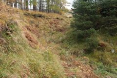

Of the three quarries located on the hillside, this is perhaps the least obvious. It is difficult to identify any quarry faces, and the most compelling evidence that this is a man-made quarry rather than a sharp defile cut by the stream is the huge tip at the western end of the quarry. The sides are steeply sloping, but not vertical, and they still retain the obvious cut in the ‘turf’ around the top, despite the rock having been almost completely reclaimed by nature.
When were these quarries cut?
It is not clear how old these quarries are. The mapping evidence is perhaps not conclusive, as they are not marked on the 1872 OS map, but are disused by the 1898 map. Unless the quarries were genuinely cut and abandoned in that 26 year gap, it seems logical to assume that they are somewhat older.
It is known that the arch at the West Quarry was constructed in 1822 to take rails for wagons, so mechanisation had come to Ballachulish earlier than that. The lack of any obvious roadways to these upper quarries suggests that they were not mechanised. It could therefore be that these quarries were opened in the 1700s, accessed on foot with ponies taking the finished slates down to the harbour. With the advent of machinery in the larger shore quarries, they became unviable and were closed.